UK maps - long/lat

I'm looking to setup a UK map which shows the location of each site around the UK using long/lat, is there a specific way that I need to format the long/lat numbers as no data is showing with the data that I currently have? Thankyou
Answers
-
@louiswatson Can you please share an example of the lat/long format that you are currently using?
0 -
Hey Michelle,
Below is the current format of our long/lat figures:
Long: -0.00880068
Lat: 51.57307951
Some figures have 8 decimals, some have 7.
Cheers
0 -
Hi @louiswatson I do not see any issue with the Lat/Long format. What settings and chart type are you using?
0 -
I'm using the long/lat map, ideally I'd like the map to only show the UK. The symbols are also quite large, is there a way to make these into pins or something smaller?
0 -
@louiswatson I would recommend a couple things to fix this:
- Under the General Chart Properties, check the box next to "Auto Zoom to Data". If all your points are within the UK, then it should frame your map to a smaller area
- Use the same value for all the points so they are the same size. You can do this by creating a beast mode with the formula AVG(1) and dragging it into the Value spot. If you need the dots to be different sizes, check the "Use Log Scale" box under the Scale chart properties instead.
2 -
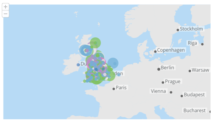
Hi Michelle,
I have changed all values to '1' but the dots are still too large, is there a way to make them much smaller so that we can see the location in more detail? Attached is the current progress. Many thanks
0

Categories
- All Categories
- 1.4K Product Ideas
- 1.4K Ideas Exchange
- 1.4K Connect
- 1.1K Connectors
- 278 Workbench
- 4 Cloud Amplifier
- 4 Federated
- 2.7K Transform
- 89 SQL DataFlows
- 556 Datasets
- 2K Magic ETL
- 3.3K Visualize
- 2.3K Charting
- 569 Beast Mode
- 11 App Studio
- 27 Variables
- 579 Automate
- 141 Apps
- 414 APIs & Domo Developer
- 23 Workflows
- 1 DomoAI
- 28 Predict
- 12 Jupyter Workspaces
- 16 R & Python Tiles
- 351 Distribute
- 91 Domo Everywhere
- 258 Scheduled Reports
- 2 Software Integrations
- 92 Manage
- 89 Governance & Security
- 9 Product Release Questions
- Community Forums
- 42 Getting Started
- 28 Community Member Introductions
- 85 Community Announcements
- 4.8K Archive